The ESRI User Conference in San Diego was a great conference to attend this year. We were able to see the new offerings from ESRI that will be available in November of this year. ESRI will be releasing ArcGIS 10.
Yesterday the White House launched the second phase of the Climate Data Initiative, focused on leveraging climate data and innovation to make food systems more resilient to climate change and reduce the impact of agriculture on climate change.
I've been working on two strategic plans for programs and facilities I am directing: GIF and IGIS, and am thinking about what are the key elements in such a plan that communicates clarity, purpose, and mission.
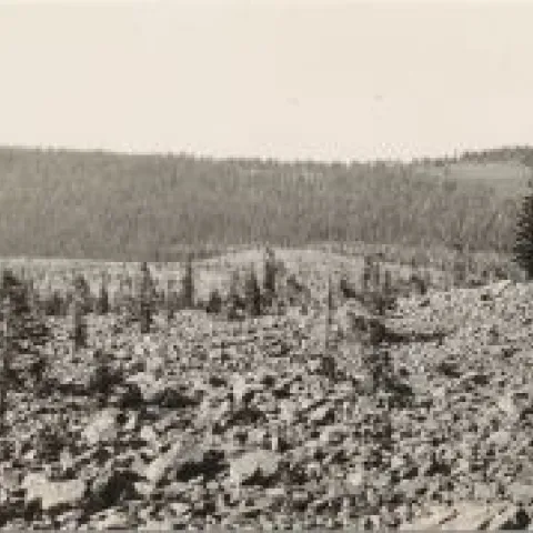
Take a look at this awesome VTM reshoot from the folks over at Geographic Resource Solutions (GRS), photographed during a recent mapping project of Lassen Volcanic National Park. Yet another great example and an incredible testament to lasting power of the VTM dataset.
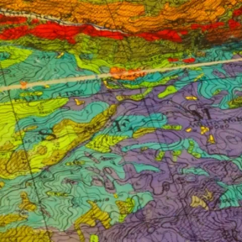
An example of a VTM vegetation map - from Shufei LeiWe have been talking recently with the HOLOS project and the IGIS InfoBase project about the need to "rescue" data and to provide frameworks for data synthesis. I present to you a profound example of these needs: the VTM project.