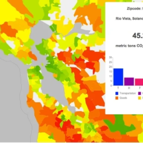
A CoolClimate Map of the SF Bay Area's carbon footprint by zipcode tabulation area shows a pattern typical of large metropolitan areas: a small footprint (green) in the urban core but a large footprint (orange and red) in surrounding suburbs.
Great news! The UC Berkeley Graduate ?Certificate ?in? Geographic ?Information ?Science ?and? Technology? (GIST)? has been approved. This certificate will provide? an ?academic? structure ?for ?an ?interdisciplinary ?exchange ?of? ideas ?around? geospatial? information ?and ?analysis.
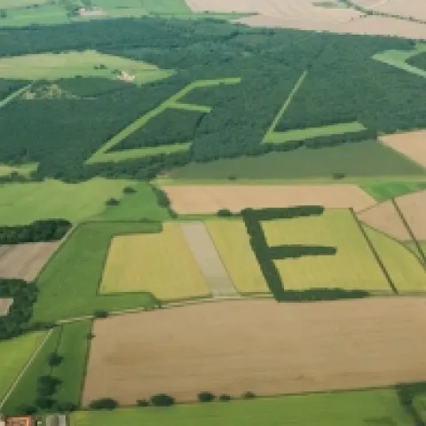
Courtesy of the International Institute for Applied Systems Analysis This creative project from GeoWiki seeks to get croudsourced feedback on crop types from participants around the world. They say: By 2050 we will need to feed more than 2 billion additional people on the Earth.
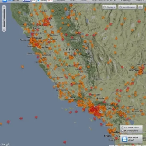
real time map of flights from planefinder.netYou've probably seen the frequently-cited "Misery Map" (D3 behind the scenes) showing how the Thanksgiving storm has blown many a tight travel plan off schedule. Here is another cool one: real-time map of all the flights in the air.